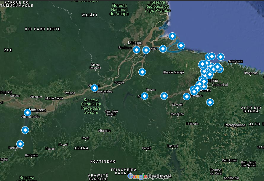
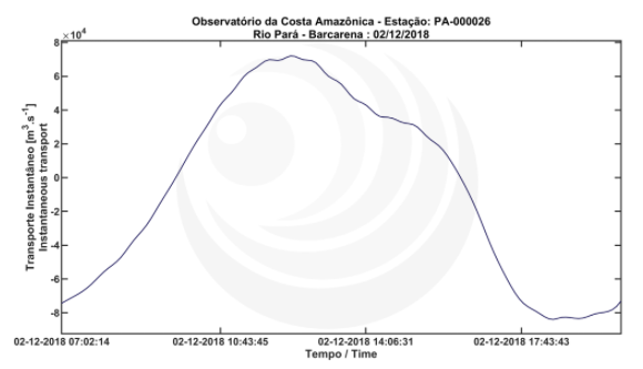
OCA presents the launch of new data available on the OCA Observational!
OCA is proud to announce the integration of 48 new Longitudinal Velocity and Instant Transport data points to our platform!
The data cover the Amazon, Pará, and Tapajós rivers areas! The oldest data are for the year 2010 and the most recent available are for 2020. You can access the new map here.
Figure 1: Examples of Longitudinal Velocity and Instant Transport images provided by OCA Observational.
One of OCA's missions is the continuous generation of data. So we are always working so that the collections are meticulous, and the analyzes are correct.