Do you know how the tides shape our beaches?
Coastal regions are in a state of ongoing transformation. Natural forces such as winds, waves, currents and the tides themselves act on them every day, in addition to the effects of human action, climate change and extreme phenomena such as El Niño and La Niña, which alter the temperature of the oceans and directly influence the coastal environment.
These regions are transition zones between land and sea, they have very particular characteristics. They are marked by dynamic processes that cause sediment to be carried from one region and deposited in another. In certain instances, rare coastal events occur, such as beach accretion, where a previously submerged coastal area is uplifted, showing that the environment is in a state of constant change.
How is this related to the Amazon coast?
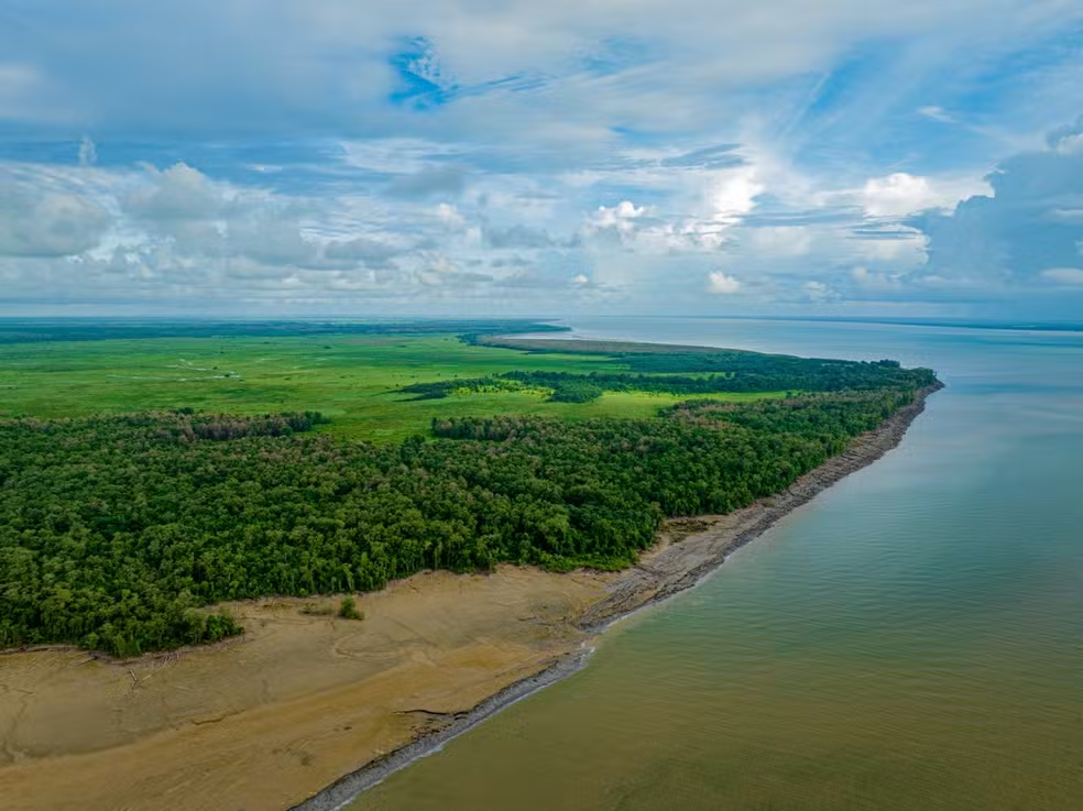
These processes are even more interesting (and complex) in tropical and equatorial areas, such as the Amazon coast. There, the meeting of large rivers with the sea, the influence of sea currents and the presence of sandbanks make the behavior of the coast quite unique. Even with so much natural and scientific wealth, this region is still little studied compared to other coastal zones around the world.
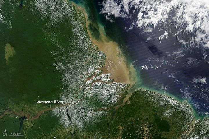
Figure 1. Amazon coast. Source: Portal Amazônia. Available at: https://portalamazonia.com/amazonia/portal-amazonia-responde-quais-as-consequencias-do-encontro-do-rio-amazonas-com-o-mar/
What is science discovering around here?
With this in mind, researcher Leilanhe Ranieri, from the Federal University of Pará (UFPA), decided to investigate how the tides influence sediment transportation on four beaches in the city of Salinópolis, in Pará. In this area, the tides have a strong influence on the movement of sediment, and understanding this process is essential to understanding the dynamics of the region.
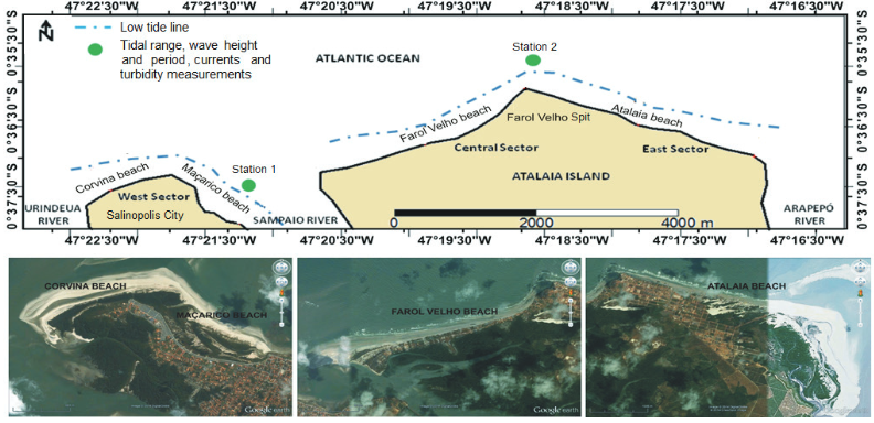
Figure 2 - Map of the data collection site. Available at: https://seer.ufrgs.br/index.php/PesquisasemGeociencias/article/view/116073/85566
In the research, sensors were used to measure tide, turbidity and wave height, as well as current meters, which record the speed of the water. The data revealed that during the ebb—when the tide is receding—especially in the rainy season, the currents reached speeds of up to 1.2 meters per second. This means that the force of the water during this period is enough to move large volumes of sediment along the coast.
Concurrently, the waves at Atalaia beach, which is one of the beaches being studied, showed increased turbulence during this period, resulting in enhanced sediment transport. Curiously, the turbidity of the water, which measures the amount of particles in the suspension, was higher during the dry season. This was due to the action of the winds and waves, which, even with less rainfall, continue to stir up the sediment and keep the water more turbid.
An examination of the two periods of the year revealed significant patterns: in the rainy season, sediment movement is mainly driven by the power of tidal currents, which are amplified by the higher rates of river flow during this time. In dry season, waves and winds play a more important role, causing changes in the shape of the coastline. These findings help us understand how different natural factors interact to shape the Amazon coastline.
References
RANIERI, Leilanhe Almeida; ROSÁRIO, Renan Peixoto; TRITINGER, Amanda Sue; EL-ROBRINI, Maâmar. Coastal dynamics on equatorial beaches of Amazonian coast during extreme tide events. Pesquisas em Geociências, v. 49, n. 1, e116073, 2022. Disponível em: https://seer.ufrgs.br/PesquisasemGeociencias/article/view/116073.