Do you go to many beaches? Did you travel on holiday and enjoy the sun and the sea? So you may have noticed that the beach shape changes over time.
These changes influence the beach sediment gain and loss depending on the seasonal period. This process is called a sedimentary balance. If sedimentary material is added, such as sands, there will be a sedimentary supply. However, if the beach material is removed, there is a sediment deficit.
The annual sediment deficit, that is, there is sediment removal throughout the year, means that a certain beach is in the process of erosion. The main processes that act on the beach dynamics are the wave regime, tides, currents, winds, the type of sediment present on the beach, the available sedimentary stock, such as cliffs and dunes; besides the human action on the beaches.
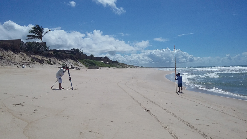
So how is it possible to evaluate these morphological variations on the beaches? Well, for that, it is necessary to measure the beach profile. This measurement uses a conventional level and a crosshair, exemplified in the photo below:

Figure 1. Beach Profile Survey realized by the Alagoas Federal University. Source: https://ufal.br/ufal/noticias/2019/3/pesquisa-mostra-grau-de-vulnerabilidade-a-erosao-na-barra-de-sao-miguel
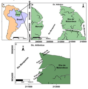
Therefore, Borba (2011) analyzed the sedimentary balance for a beach on the Maiandeua island (Algodoal), located in the state of Pará. The author calculated the sedimentary balance for 9 days, during the dry period, on the Caixa d'água beach.

Figure 2. Location of the study area. (A) location in South America, (B) location according to adjacent physiographies, (C) location of the beaches under study. Source: Florida Center for Instructional Technology, data collection scheme for the beach profile.
During this period, the author observed a sedimentary loss of 163.84 m³. This is equivalent to 163 water tanks of 1000 L spent in 9 days! Can you believe it? The greatest loss occurred on the steepest part of the beach due to the great influence of the variation of the tide, which is classified as macrotidal, with heights of 4.5m!
So the next time you go to the beach you already know that it will be different from your memory, always changing and shaping according to the tide and waves!
References
Borba T. A. C. 2011. MORFODINÂMICA E HIDRODINÂMICA DE PRAIAS DO LITORAL NORDESTE PARAENSE, BRASIL. Trabalho de Conclusão de Curso (Graduação), Instituto de Geociências Universidade Federal do Pará, Belém (PA). Disponível em: http://bdm.ufpa.br/jspui/handle/prefix/1867
